

Tipsa dina vänner om produkten:
Rand McNally Folded Map: Hawaii State Map
Rand Mcnally

Rand McNally Folded Map: Hawaii State Map
Rand Mcnally
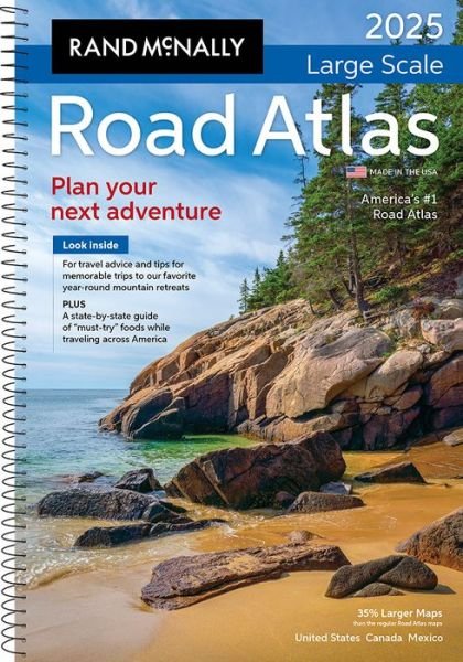
Rand McNally's folded map for Hawaii is a must-have for anyone traveling in or through the state, offering unbeatable accuracy and reliability at a great price. Our trusted cartography shows all U. S., state, and county highways and much more. - Points of interest. - State Park chart. - State mileage chart. - Driving times map. - On-the-road toolbox. - Visitor center information. - Climate data. - State facts & symbols. - Easy-to-use legend. - Detailed indexed. Coverage Area Detailed maps include: Hawaii Volcanoes National Park, Hilo, Honolulu & Vicinity, Wailuku. Product Details: Measures 9.0 x 4.125 and folds out to 25.5 x 36.75.
| Media | Böcker Pocketbok (Bok med mjukt omslag och limmad rygg) |
| Releasedatum | 7 mars 2022 |
| ISBN13 | 9780528025747 |
| Utgivare | RAND MCNALLY |
| Mått | 158 g |
| Språk | Engelska |
Fler produkter med Rand Mcnally


Andra har också köpt
![Cover for Preben Hansen · Turen Går Til: Turen går til Californien & Vestlige USA (Poketbok) [5:e utgåva] (2021)](https://imusic.b-cdn.net/images/item/original/578/9788740063578.jpg?preben-hansen-2021-turen-gaar-til-turen-gaar-til-californien-vestlige-usa-poketbok&class=scaled&v=1623395637)
![Cover for Ole Lund Kirkegaard · Læs selv: Læs selv Frode - og alle de andre rødder (Inbunden Bok) [4:e utgåva] [Indbundet] (2010)](https://imusic.b-cdn.net/images/item/original/121/9788702094121.jpg?ole-lund-kirkegaard-2010-laes-selv-laes-selv-frode-og-alle-de-andre-roedder-inbunden-bok&class=scaled&v=1331420409)
![Cover for Yahya Hassan · Yahya Hassan 2 (Poketbok) [1:a utgåva] (2019)](https://imusic.b-cdn.net/images/item/original/866/9788702265866.jpg?yahya-hassan-2019-yahya-hassan-2-poketbok&class=scaled&v=1573199860)
![Cover for Peter Ingemann · Den Gyldne Hest (Inbunden Bok) [1:a utgåva] (2021)](https://imusic.b-cdn.net/images/item/original/526/9788702330526.jpg?peter-ingemann-2021-den-gyldne-hest-inbunden-bok&class=scaled&v=1633520816)


Se alt med Rand Mcnally ( t.ex. Pocketbok , Kartor , Inbunden Bok , Bok och Spiralbok )